SEFS research scientists assist in launch of the Washington State Zoning Atlas
First-of-its-kind tool increases our understanding of how zoning affects forest land conversion and conservation
The Natural Resource Spatial Informatics Group (NRSIG), a research group within CINTRAFOR here at the School of Environmental and Forest Sciences, has assisted in the launch of a first-of-its-kind tool that can translate local zoning into standardized categories for easy comparison.
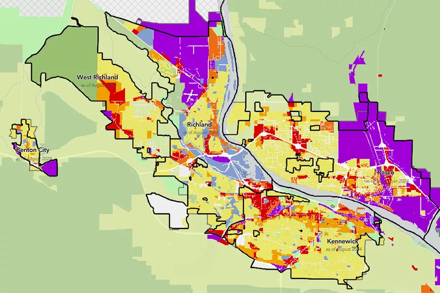
The newly launched Washington State Zoning Atlas, or WAZA, is available as an interactive web-based map and downloadable database. Until now there has been no way to publish or organize zoning codes because cities and counties have the power to manage their own zoning rules under Washington’s Growth Management Act. The zoning rules have made it near impossible to compare zoning info across the state. That is about to change.
Led by the Washington State Department of Commerce, WAZA will help ecologists, urban planners, architects, policy makers, local governments, analysts and researchers answer big questions about the future of housing in Washington, predict and assess economic trends, identify areas prone to flood or wildfire and predict future transportation issues, as examples.
Students have used WAZA to develop maps analyzing:
- How parking minimums across the state influence household driving rates
- Proximity of multifamily zoning to highways and the demographics of households in these areas
- The relationship between zoning and pedestrian infrastructure improvements
Read the full press release here
When asked how he envisions this tool’s future applications, NRSIG research scientist and engineer Luke Rogers shared, “In addition to the hot topic of housing affordability that drove the creation of the WAZA, here in SEFS we are excited to utilize this data to increase our understanding of how zoning affects forest land conversion and conservation. Integrated with the Washington State Forestland Database, WAZA will help highlight where forestland properties may be at risk of conversion to non-forest uses, and help quantify how county comprehensive plans and city zoning affect forest management and land use decisions.” Learn more about the ways WAZA can support research and policy analysis across different land use scenarios here. Rogers and Andrew Cooke, another research scientist with NSRIG were responsible for the data development and integration work necessary to get WAZA off the ground.
Other UW collaborators include Branden Born, an Associate Professor in the College of Built Environments, Justin Patterson, Master of Urban Planning student in the College of Built Environments and Gregory Lund, Associate Teaching Professor in UW Tacoma’s School of Urban Studies.
Want to try your hand at the tool? Learn more and open WAZA here.