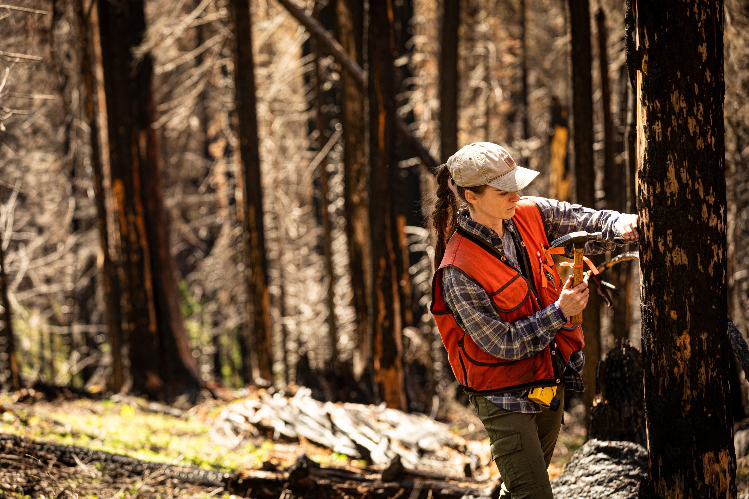
What remains after wildfire here on the wet westside?
In a warming world, research that informs forest management actions and forest resilience are more important than ever
New research out of the Harvey Lab and conducted by recent PhD graduate Jenna Morris builds foundational understanding of the effects of fire in wet temperate forests like the ones here on the westside of Washington state, building essential understanding of fire effects in forests shaped by infrequent and high-severity fires.

Fire is a natural part of all forest ecosystems—even on the wet westside—and every one of us in the Pacific Northwest is affected by wildfire, from direct threats to homes and livelihoods and exposure to smoke, to the destruction of the areas where we like to recreate.
Forests in western Washington and northwestern Oregon (“northwestern Cascadia”) are among the most productive in the world, boasting large amounts of biomass (live and dead vegetation) that support many cultural, ecological, and economic services. On top of this, these forests are prone to large, fast-moving and severe wildfires. Given that Western Washington is also home to nearly 80 percent of the state’s population, current and existing fire management strategies that work to combat and mitigate wildfire on the eastside of the state may not be as effective on the westside.
When forest fires occur on the westside they represent a crucial opportunity to address research priorities for anticipating effects of future change on forest dynamics. Associate Professor Brian Harvey, his lab group, scientists Dan Donato and Josh Halofsky at the Washington DNR, and a large group of collaborators at land management agencies have been collecting field data across recent fires in the northwest Cascades. Key to this research is a constellation of plots in larger fires including the 2017 Norse Peak and Eagle Creek fires, and some of the Labor Day fires that occurred in 2020: Big Hollow (near Stevenson, WA), Riverside (near Estacada, OR) and Lionshead (near Detroit, OR).
For her PhD research, Morris and her team measured live and dead vegetation 2-5 years after these fires to examine the drivers of two important post-fire legacies: carbon and fuels. The 95 plots that her team surveyed, included data points from:
- Young forests (~30–50 yrs) – planted following clearcutting in the mid-1900s
- Mid-seral forests (~120–150 yrs) – originated from fire or clearcutting after Euro-American settlement in the late 1800s
- Late-seral / old-growth forests (~160–500+ yrs) – originated from fire prior to Euro-American settlement
The plots also included forests burned at varying levels of severity. We sat down with Morris and Associate Professor Brian Harvey to discuss the findings of the study, its implications and what it means for the future of wildfire here on the wet westside.
Interview with Jenna Morris and Brian Harvey
Why did you make wet temperate forests the subject of this research?
Jenna Morris: At its core, this research sits in the lens of the PNW – forests are very much part of our identities in this region. And where there is forest, there is fire. This is true even in forests that are typically very wet, like those on the west side of the Cascades. As the climate warms, fire activity is increasing across the globe, including here in Washington, raising questions about how we can promote forest recovery and reduce future fire risk on the westside.
Recent fires in the western Cascades have burned an area nearly 10 times larger than Seattle. For example, the Labor Day fires that occurred in 2020, including Big Hollow (near Stevenson, WA), Riverside (near Estacada, OR), and Lionshead (near Detroit, OR), directly impacted communities, recreation, trails (including the PCT), and highways. Fires of this size and scope can also impact rail transit and the economic transport of goods – for example, Amtrak and BNSF Railway rerouted and suspended operations during the 2022 Bolt Creek fire near Skykomish, Washington. An indirect and undeniable impact of these fires is the smoke that accompanies them. These fires often get big quickly and produce a ton of smoke. Many will remember recent summers in Seattle and other parts of the state where we have had terrible air quality from these fires, even in places which may be hundreds of miles away from where the fires are actually burning.
It is important to understand the effects of these recent fires on forest structure and function so we can make management decisions that support forest resilience to future change. Currently, there is a big gap in our understanding of fire effects in ecosystems where fire occurs less frequently. A great example of these ecosystems is right here in the Pacific Northwest: the wet temperate forests west of the Cascade Range crest are adapted to large and severe wildfires that occur infrequently, at intervals between one to several centuries. Combined with the unique social-ecological context of these forests (e.g., western Washington is home to nearly 80 percent of the state’s population), this creates different challenges for managing fires here compared to drier places, like on the east side of Washington state. Until recently, opportunities to study large fires in these forests have been uncommon. Recent fires have allowed us the chance to fill a critical knowledge gap and build fundamental understanding of fire effects in these ecosystems.
Why has it taken so long to look closely at fires here on the westside of Washington in wet temperate forests?
Brian Harvey:
The main reason is simply that fire on the west side is less frequent than many drier forests elsewhere in the western US, and there haven’t been many opportunities until recently to go in and characterize westside fires, understand what drives them, and document in real-time how forests can recover from fire. There can be a common misconception that the 2020 fires, including the Big Hollow Fire, the Beachie Creek Fire, and the Riverside Fire, were anomalous, and unprecedented; however, if you look back into the history of fire in the western Cascades, there are fires similar in size and scope, with similar drivers. For example, the Yacolt Burn of 1902 in southwestern Washington and the 1933 Tillamook Burn in northwestern Oregon were pretty similar in nature to what we saw in 2020. Similar to those historical fires, these recent large fires on the west side are commonly driven by strong dry winds coming from the east and blowing up and over the Cascades. Now one very important dimension is that those historical fires were followed by abundant and frequent reburns of those areas.
Up until the recent fires, since 1902 and 1933 more area had burned in the footprints of those past fires (Yacolt and Tillamook) than nearly anywhere else on the west side of the Cascades. One theory as to why more fires occur in the footprint of previous fires is because fires change the microclimate of the burned area. The areas become more exposed, hotter, drier and windier. The missing piece of the puzzle lies within these new microclimates and the question becomes, “will there be enough fuel for a second fire to burn? And if so, how severely?” Jenna Morris’ research quantified this question around fuels and will help us begin to answer those questions and fill in the missing pieces. The general thinking is that microclimate conditions changes can cause these secondary subsequent fires – if there is enough fuel to sustain fire.
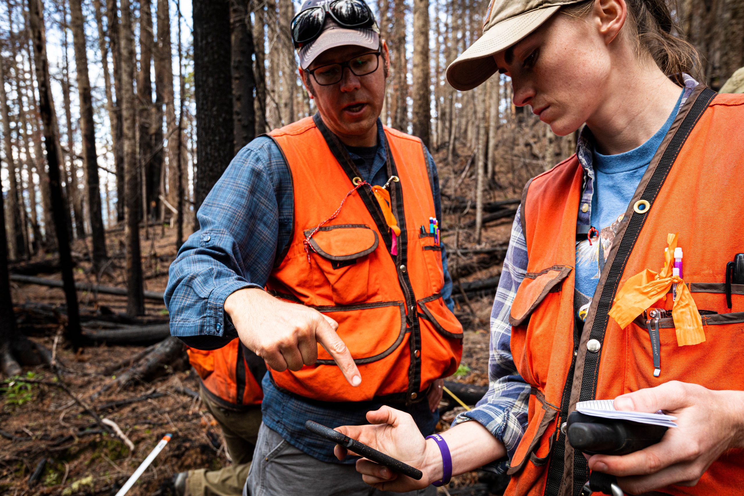
Can you walk us through what performing this research looked like? What were you hoping to measure? Have you been surprised by any of your findings?
JM: The Harvey Lab group has been carrying out a multi-year field campaign that started during the summers from 2019 to 2023, visiting five recently burned areas across the northwestern Cascades to characterize forest structure shortly after fire. We sampled forests that were burned at either high or low severity, as well as analogous unburned areas to serve as a control for comparison. These areas included young forests that were replanted after clearcutting in the late 1900s, middle-aged forests that established naturally following timber harvest or fire in the mid-to-late 1800s, and old-growth forests that originated from fires more than 200 years ago. In total, we established 95 long-term monitoring plots across four National Forests. Our lab group will be continuing to revisit these plots every few years to catalog forest recovery after fire over time.
One of our major goals of this field sampling was to characterize the effects of fire on aboveground carbon and fuels in these forests. To do this, we went by foot into each sampled site and measured the aboveground biomass. This biomass is simply all the living and dead plant matter on or above the forest floor, including surviving trees, standing snags, new seedlings, understory shrubs and forbs, leaf litter, twigs, and fallen logs. Since we can’t easily collect and weigh all these components in the forest, we use other techniques to estimate the amount of biomass at these sites. First, we took individual measurements on the trees, understory plants, and dead wood present, including their diameter, height, cover, count, and level of decay. We then used specialized equations to determine how much these components weigh, based on their species, size, and abundance.
While not necessarily surprising, I have been impressed at the robustness of these burned forests. We’ve been seeing very dynamic recovery after high-severity fire, with rich understory plant diversity, rapid growth of woody shrubs, and abundant regeneration of tree seedlings within just the first few years. These areas burned at high severity represent rare structurally complex early seral ecosystems – the beginning stages of forest recovery where non-tree vegetation (e.g., shrubs, herbs, grasses) dominates and supports biodiversity of plant and animal species that thrive in more open environments. Areas burned at low severity may assist in the recovery of these more severely burned forests by providing a source of seeds from the remaining live trees to support the establishment and growth of new tree seedlings.
Can you tell us a bit more about how this work catalyzed the development of a field guide? How do you imagine other fire researchers will use your field guide?
JM: A key part of our field sampling involved learning how to visualize and reconstruct what the forests looked like prior to fire – think forest forensics. However, identifying tree species in burned forests can be difficult since many of their characteristic features (e.g., leaves, cones, bark) are consumed or heavily altered by fire. An unexpected outcome of our work has been developing alternative ways to reliably characterize trees when burned, garnered from months and years of field experience. Some of these characteristics include the appearance of remaining bark or the arrangement of limbs and branches. For example, we’ve noticed that some tree species often retain most of their bark when burned (e.g., Douglas-fir), while other species have bark that commonly sloughs off shortly after fire (e.g., western redcedar). Having some general information on the disturbance or management history, environmental conditions, and vegetation zone of a location can also help us make educated guesses about what tree species might have been present prior to burning. Turning this information into a field guide will be a really helpful way to preserve this institutional knowledge. Though perhaps a bit niche, this kind of guide would be directly useful for not only our future field crews, but also other researchers and managers (or even curious individuals) working and recreating in burned forests across the region.
Why has much of your research focus been around carbon storage and fuels?
JM: One of the main reasons we are focused on carbon is because carbon cycling is a major ecosystem function. You also can’t address climate change without talking about carbon. Our forests here on the west side of the Cascades are among the most productive in the world, storing vast amounts of carbon. Accordingly, our region is often at the forefront of climate change policies, such as adoption of alternative forestry practices and engagement in mitigation strategies like carbon markets. Wildfires alter carbon dynamics by killing and consuming vegetation and creating opportunities for new growth, thus it is important to characterize the ecological consequences and broader implications of fire on forest carbon in our region.
We found that these forests retain most of their biomass after fire – burned forests had at least two-thirds of the total carbon of unburned forests. In forests that were burned at low severity, more than 70% of this carbon was stored in live biomass, while in forests burned at high severity, more than 95% of this carbon was stored in dead biomass. All burned forests also had a considerable amount of charred wood, which represents a form of carbon that is particularly resistant to decay. These findings suggest that persistence of this biomass in burned forests, even as it decays, will buffer total ecosystem carbon storage as live vegetation recovers over time.
This carbon also represents fuel. The type, amount, and arrangement of fuels in a forest can influence the way a fire burns. In this study, we focused on fuels to understand how one fire may influence the occurrence and behavior of a future fire. Fires often temporarily reduce the likelihood or severity of a subsequent fire by removing fuels. However, this effect may be weak or nonexistent in highly-productive ecosystems, where fuels can re-accumulate quickly due to rapid recovery of live vegetation. This appears to be the case in the northwestern Cascades.
We found that even just two to five years after fire, fuels were likely abundant enough to support burning again in all the forests we sampled, regardless of pre-fire conditions or burn severity. This suggests fuel reduction benefits from fire are a short-lived limitation on subsequent fire occurrence on the westside. Though, fuels are just one piece of this, and further work is needed to disentangle the drivers of reburn potential in these ecosystems.
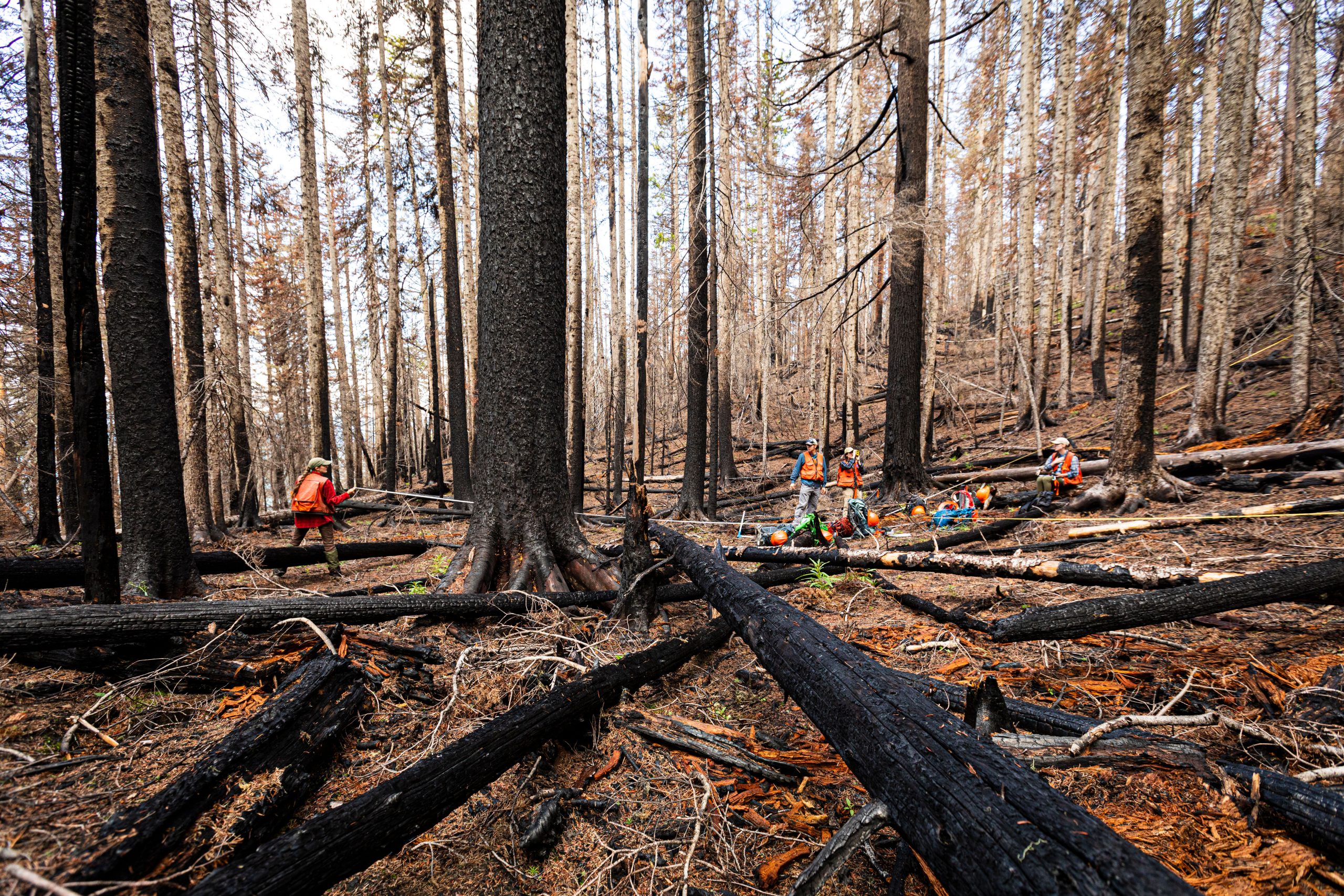
BH: One of the big takeaways here is that this really helps us put together a broader understanding of short-interval reburn risk and what one fire means for a subsequent fire, in addition to just how much carbon remains after fire. When many of us envision a “stand-replacing” or “severe” fire, we picture a landscape with nothing remaining, but there is so much material remaining that is storing carbon and at the same time is available as fuel for future fires. Morris’ PhD research fills a really important gap in understanding these aspects of fire on the west side of the cascades. By quantifying the fuels that remain after fire, we now know a lot more about the mechanisms of these short-interval reburns and how they can occur. By quantifying how much carbon remains on these burned landscapes, we know a lot more about how carbon can be stored in these forests for potentially a very long time – even after a fire occurs. For example, post-fire carbon was 3-4x higher than forests that were older compared to younger forests. This makes you think about the value of old growth. A lot of that persists in old growth post fire. This is valuable for ecosystem functions, carbon cycling, and wildlife habitat.
The video linked above highlights the value of fire, what fire brings to the biodiversity of understory plant communities and how different species use these burned forests for nesting like woodpeckers and those that rely on the decay of a forest fire.
What is your research teaching us about the legacy of old growth forests?
JM: This research highlights how forest recovery after fire really depends on what the forest looks like before the fire. We found that forests that were older at the time of fire had 3–4 times more carbon after fire compared to younger forests. In other words, forests with high amounts of carbon pre-fire (e.g., old-growth forests) are likely to remain high carbon forests after fire, and vice versa. Related work from our lab has shown that these older forests also have greater abundance and richness of tree seedlings after fire compared to younger forests that burn, pointing to stronger post-fire recovery. These findings show that pre-fire forest age is a major driver of post-fire outcomes, and suggest that even when burned, old-growth forests may have greater potential than younger forests to support many ecosystem functions like carbon storage, nutrient cycling, biodiversity, and wildlife habitat.

You were recently awarded funding to support future research. What will you do with it? What’s next?
BH: The part of this westside fire work that Jenna led in her PhD shows strongly how fire shapes the fuel available for another fire, but fires also change the structure of the forest in ways that alter local weather conditions. As weather is another key ingredient in the recipe for fire, understanding if recently burned forests experience local weather or microclimates that are more or less conducive to fire becomes important. To understand this, in a current project supported by the National Science Foundation, we are building and installing meteorological stations across an array of our post-fire plots in the western Cascades. These meteorological stations will help us remotely measure how factors such as temperature, soil moisture, wind direction, wind speed, humidity and other local weather conditions that would be relevant to future fires potentially vary across levels of past fire history. Ultimately, that will help us understand if fire risk is heightened or lessened in recently burned forests compared to unburned forests, and correspondingly help us inform forest and fire management with our collaborative partners on this work.
What does this research mean for prescribed burns? Are they related?
JM: While this research is not directly related to prescribed burns, since we focused only on wildfire in forests without evidence of recent management activities, but it does inform some thought around the topic of prescribed burns in wet forests. Prescribed burns are commonly implemented to reduce fuels. In dry forests, like those of the eastern Cascades, prescribed burns often mimic the natural role of fire (i.e., frequent, low severity) and can be an effective management strategy for restoring forest structure and decreasing the severity of potential wildfires. However, in wet forests, like those of the western Cascades, prescribed burns may not be as effective. Vegetation regrowth after fire can be rapid in these high-productivity systems, so any fuel reduction benefits from prescribed burns would likely be brief and very resource-intensive to maintain. For instance, this research shows that even after a severe wildfire, total fuel loads in westside forests may be large enough to support another fire within just a few years. Ultimately, we cannot say that there is no role for prescribed burns on the westside, but more work is needed to further explore the effects of fuel treatments on fire and forest dynamics in this region.
Read the paper in Ecosphere, Pre-fire structure drives variability in post-fire aboveground carbon and fuel profiles in wet temperate forests.